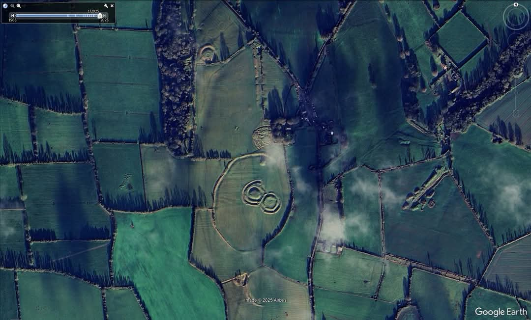
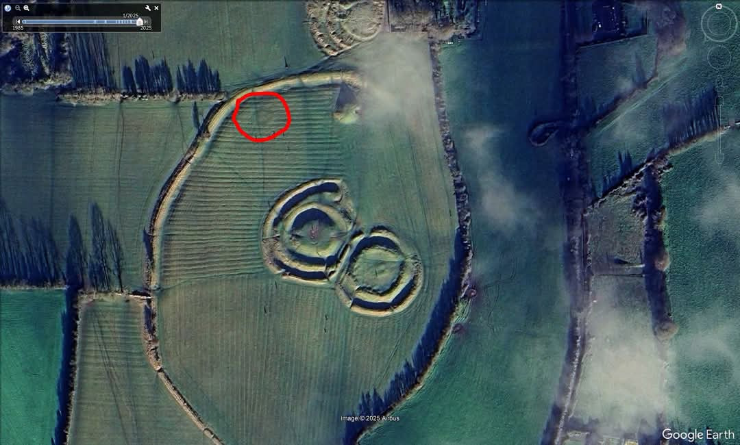
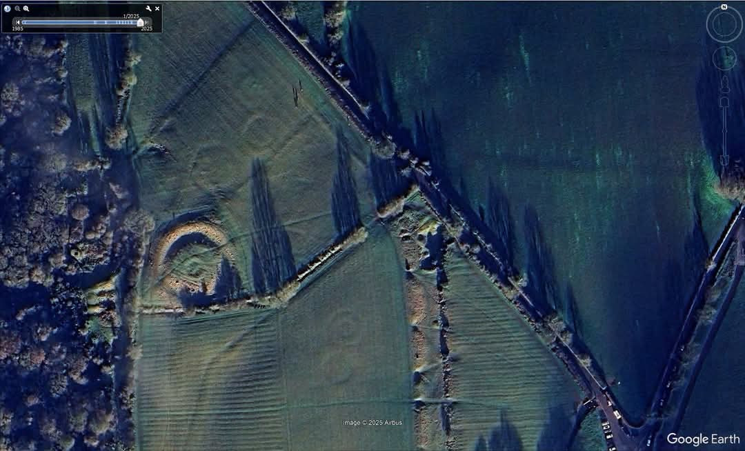
The Hill of Tara’s archaeology is gloriously visible in the latest Google Earth imagery, taken in low midwinter sunshine on New Year’s Day 2025. The first image show a view of Tara and its monuments. In the second image, the red circle shows the clearly visible site of Siar Dumha na mBó (Western Mound of the Cow), which was damaged or destroyed in recent centuries. It may be a Bronze Age barrow, with a further possibility that it was another passage-tomb like Dumha na nGiall (Mound of the Hostages) immediately to its east. In the third image, some of the Bronze Age barrows near the Banqueting Hall, as well as Rath Gráinne and its satellite barrows, are wonderfully visible. In the fourth image, a large hilltop enclosure – a possible henge – which was first revealed using ground-penetrating radar and other geophysics by the Discovery Programme about 25 years ago, can be seen (arrowed). The ‘twin’ mounds of An Forradh and Teach Chormaic are shown in exquisite detail in the fifth screenshot. If you look in the interior of Teach Chormaic (Cormac’s House), you can see a rectangular-shaped structure, which is the possible remains of a dwelling. The final image shows the partly ploughed-out remnants of Rath Laoghaire. Also shown is a map of Tara based on older maps of the monuments by O’Donovan and Hartigan.
Tara and its monuments
Western Mound of the Cow
Bronze Age barrows
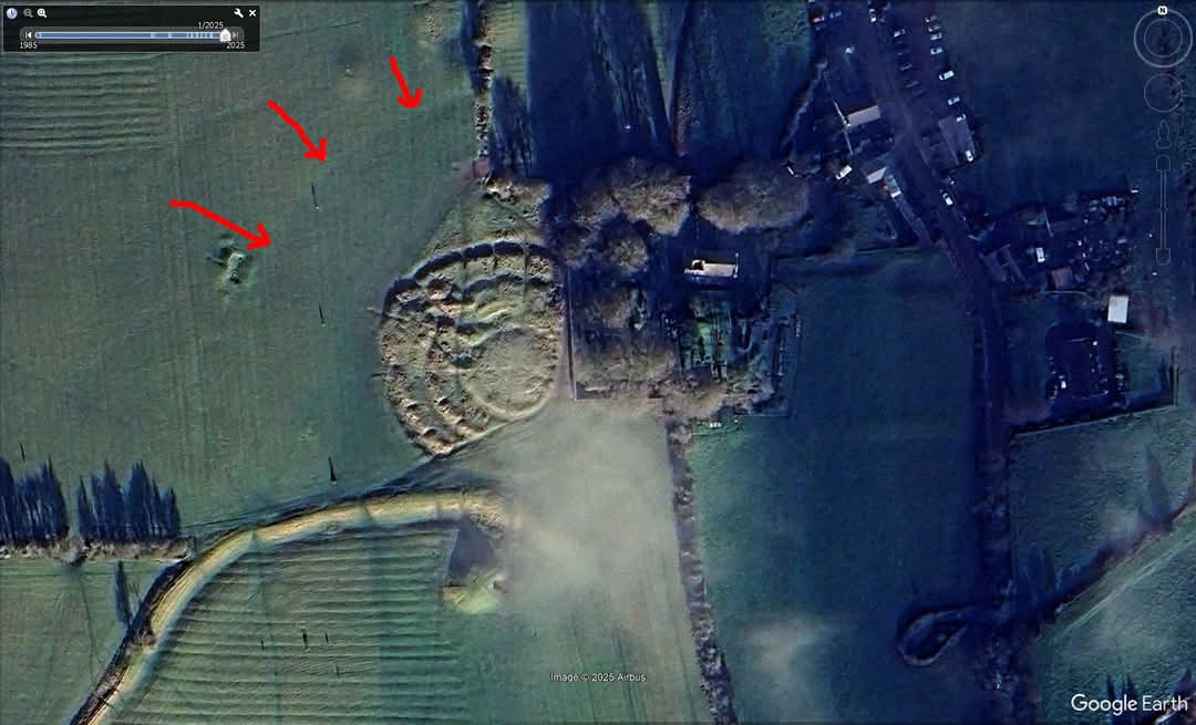
A large hilltop enclosure
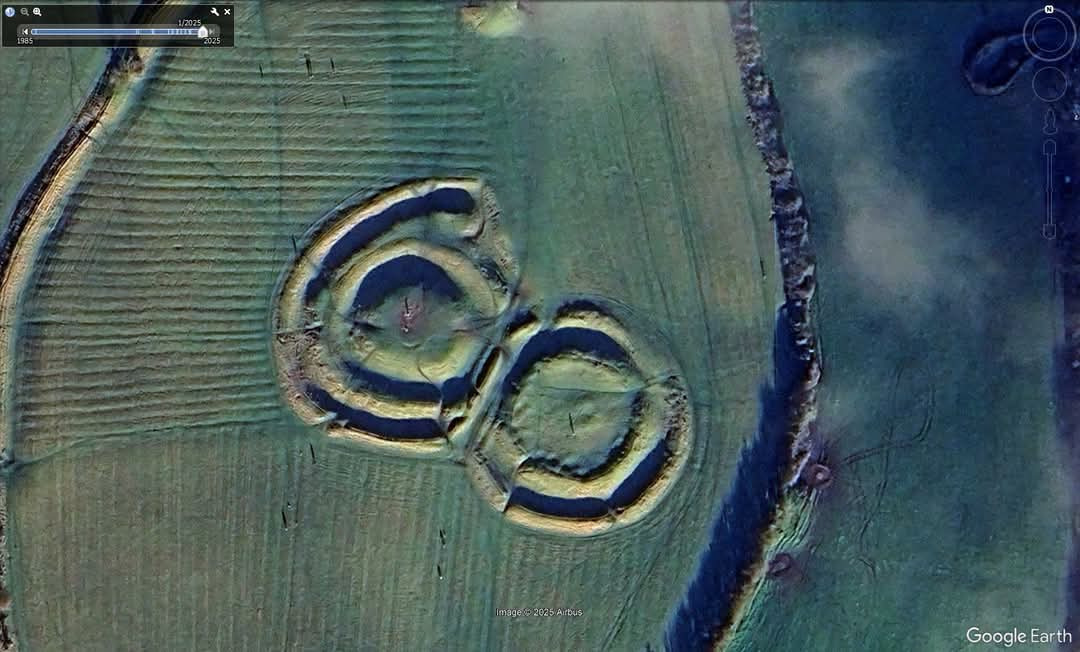
The ‘twin’ mounds of An Forradh
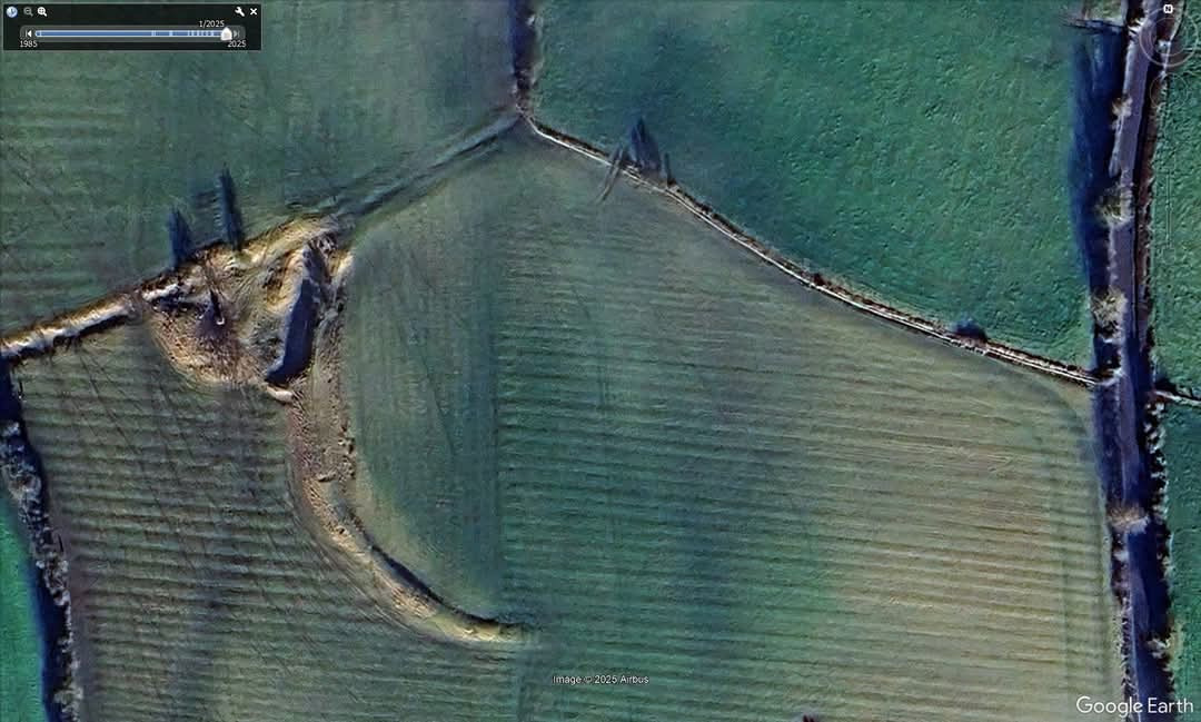
The remnants of Rath Laoghaire
https://www.facebook.com/share/p/1AVppDMsFn/
Experience Medieval Archery; Waterford. +353 866017176
Tour-Guiding: Culturally Curious Tours. Email: Peter@peterstours.ie
Website: Culturally Curious Tours
Winner of the E.U.Green Flower Award for eco-accommodation.
Glenribbeen Music School; Nursery to the living culture. Archery lessons in safe environs. Bat Walks and historical walks ‘n’ talks.
http://www.sigtrygg.com/ Glenribbeen Eco Blog; http://pfiddle.wordpress.com/
A holiday experience without the footprint.